What do scientists see when looking at Earth’s atmosphere? Well, it’s complicated, especially the chemistry of the atmosphere. According to NASA scientist Christoph Keller, “it’s so complicated, and it changes so rapidly on a short scale, we’re not necessarily able to observe it all the time, everywhere.”
NASA’s Scientific Visualization Studio states that atmospheric chemicals go through “rapid changes as they are being emitted by natural and anthropogenic activities, transported by prevailing winds and vertical lifting motions, deposited to the surface, or chemically transformed.” That’s why this new visualization tool from NASA is vital to understanding and forecasting atmospheric chemistry.
According to the video, the visualization shows the composition of Earth’s atmospheric chemistry as it relates to air pollution. The scientists in the video state that hundreds of chemicals contribute to air pollutants, and this combination of satellite data and modeling shows how the chemicals are reacting with one another.
Lesley Ott, a research meteorologist at NASA’s Goddard Space Flight Center, “merging models and satellite data give a more complete picture of what’s happening throughout the atmosphere.” With this visualization tool, they’re able to see gases not captured by satellite imagery. They’re also able to monitor pollutants that may impact public health and use that communicate that information to stakeholders. Keller says that the models can show where pollutants are formed and destroyed, how they are created, and how they can be mitigated as needed related to public health.
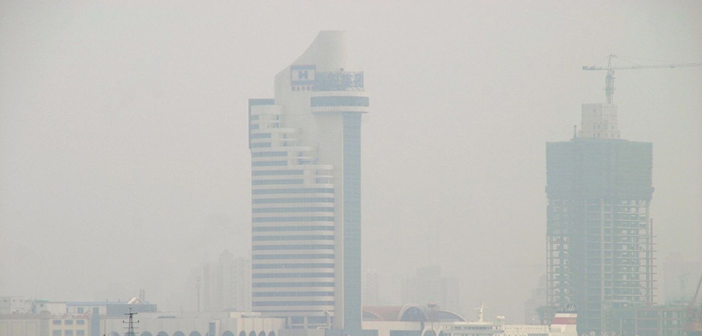
The formation of surface ozone is shown in the visualization in the video. According to an article from NASA regarding the tool, 96 chemical species form surface ozone, a gas that is toxic to most plant and animal species. In addition to satellite imagery, the simulation uses computer modeling from the GEOS Composition Forecasting (GEOS-CF). GEOS-CF incorporates the interactions of 240 chemical species and the over 700 chemical reactions that impact the formation of ozone.
According to NASA, merging satellite data with GEOS-CF provides a snapshot of atmospheric chemistry and can be used to predict global air quality. GEOS-CF fills in data gaps left by satellites, which observe natural and anthropogenic chemical species in the atmosphere. Using this model, scientists can create a 5-day forecast. NASA hopes that the information in these forecasts could be used by academic researchers, government scientists, air quality managers, and the general public.
Sources: NASA Scientific Visualization Studio, https://svs.gsfc.nasa.gov/13580