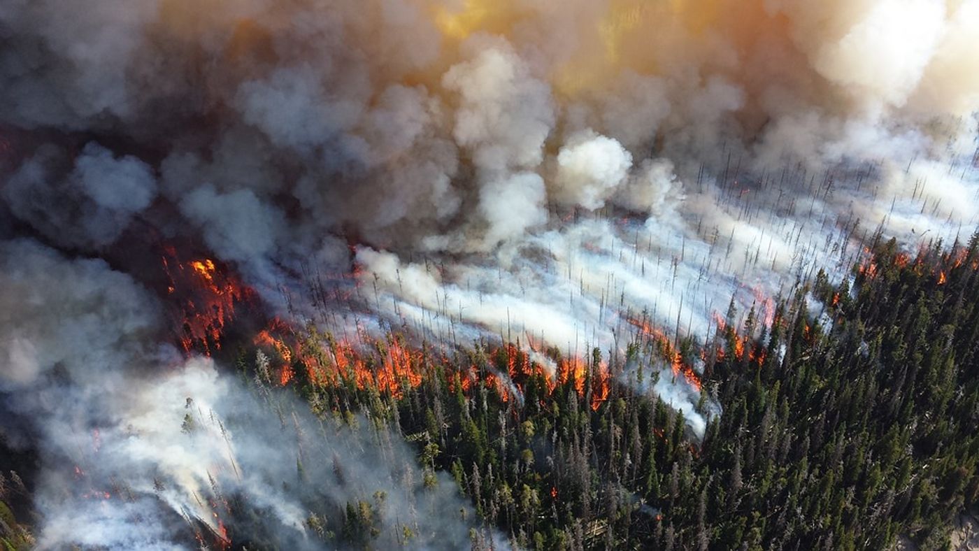
Hydrology researchers have banded together with environmental engineers and remote sensing specialists to develop a deep-learning model that will aid the Western US as the wildfire season of 2020 begins. The model measures fuel moisture levels with precision in twelve states across the West and Pacific Coast.
Live fuel moisture level is a complex measurement to obtain. Senior author of the paper, Stanford University ecohydrologist Alexandra Konings, explains.
"You look at how much mass was lost in the oven, and that's all the water that was in there. That's obviously really laborious, and you can only do that in a couple of different places, for only some of the species in a landscape.” Konings is an assistant professor of Earth system science at Stanford's School of Earth, Energy & Environmental Sciences (Stanford Earth).
The U.S. Forest Service has gathered over 200,000 measurements from hundreds of sites over the last half-century, all of which are recorded in the National Fuel Moisture Database, we still don’t have a strong understanding of how plant water content changes over time from one plant to another -- or from one ecosystem to another.
Because of a lack of accurate and complete data, scientists have had to extrapolate fuel moisture content based on estimates of existing data and informed guesses about relationships between temperature, precipitation, water in dead plants, and the dryness of living ones. But all that is changing with the help of AI.
"Now, we are in a position where we can go back and test what we've been assuming for so long -- the link between weather and live fuel moisture -- in different ecosystems of the western United States," emotes lead author Krishna Rao.
With the help of a recurrent neural network, the researchers mapped live fuel moisture content every 15 days at 250 meters resolution over the western US using microwave backscatter and optical reflectance.
"One of our big breakthroughs was to look at a newer set of satellites that are using much longer wavelengths, which allows the observations to be sensitive to water much deeper into the forest canopy and be directly representative of the fuel moisture content," commented Konings.
The researchers hope their high-resolution dynamic maps will help fire managers reduce wildfire risk in the coming months. "Creating these maps was the first step in understanding how this new fuel moisture data might affect fire risk and predictions," Konings concludes. "Now we're trying to really pin down the best ways to use it for improved fire prediction."
Sources: Remote Sensing of Environment, Science Daily